
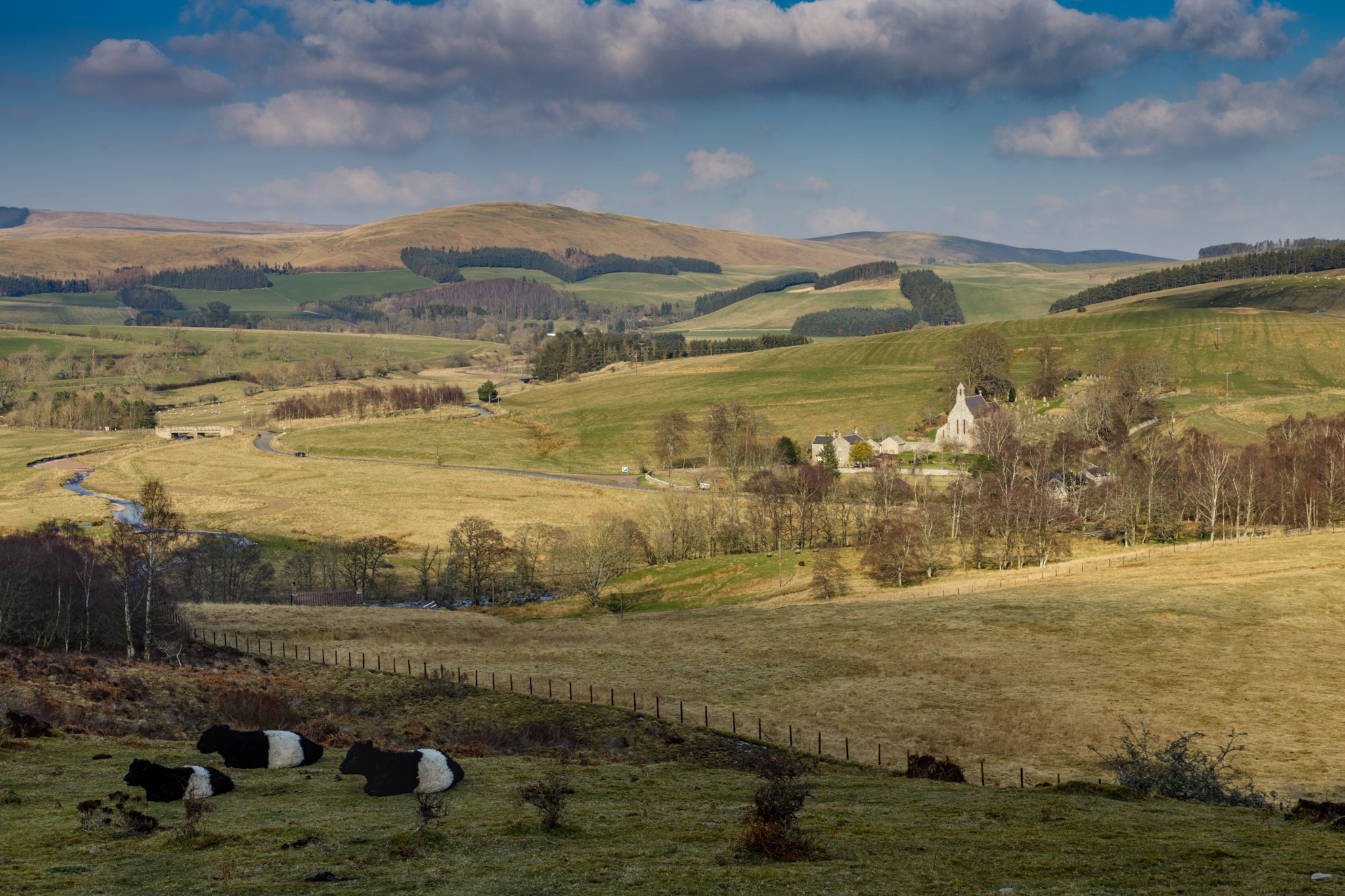
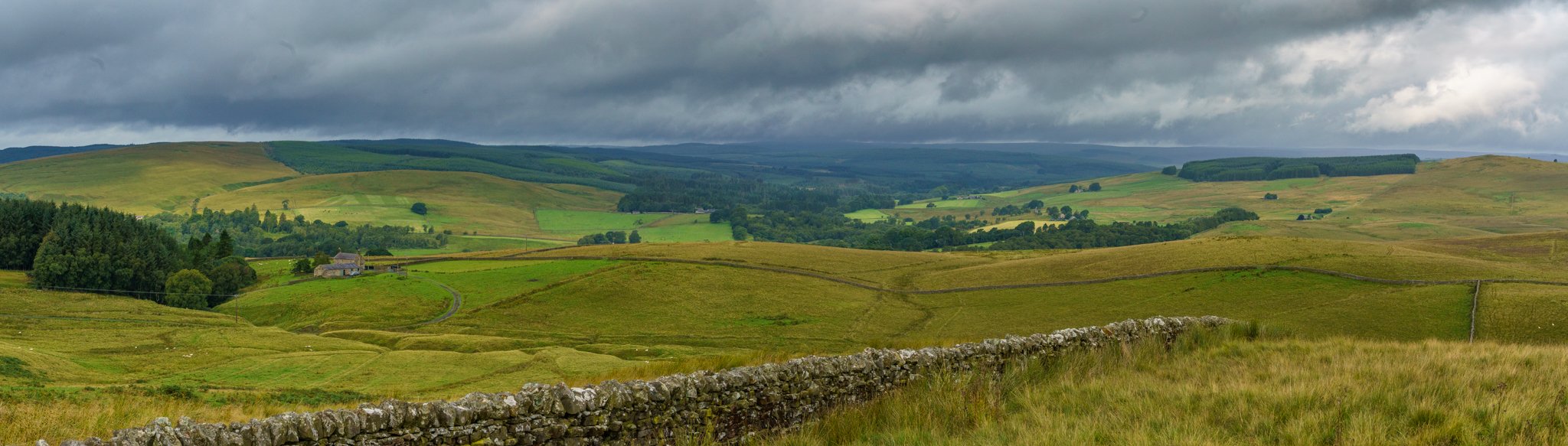
Holy Island
My top routes and places to visit in Northumberland…
If you want to feel like you’re abroad without flying or getting on a ferry, this is the place for you. It’s such a stunning place to spend the day and walk, exploring the islands features and history along the way.
I have to point out very early on that you need to check the safe crossing times for the island as the causeway is cut off at high tide. I’ve seen far too many news articles of stranded vehicles caught out. I’ve popped a link below to make it easier if you want to check when is safe to cross.
Once we have checked when it’s safe to cross we normally head up first thing in the morning to make the most of the day. I particularly like it when we go across and maroon ourselves on the island, crossing just before high tide. You’ll find it’s not as busy as going over just after the high tide crossing times!
There are plenty of things to do and see on the island so allow a good few hours, we normally take a picnic and have it on the beach round from the castle but there are a few places you can grab some food and drinks from.

Such a wonderful castle
We set off nice and early in the morning to make sure we didn’t miss the crossing times and headed up the A1. The day was looking to be a scorcher and being by the coast would make it a bit cooler for us. I’m not one for too much heat and there’s not much in the way of shade when you’re on the island.
After coming off the A1, we headed a short distance down the road towards the causeway. When you see the causeway for the first time, it’s an amazing sight. There’s the refuge hut for stranded people that you pass by and on right, there are wooden poles peeking out from the bay. These poles mark the path for the Pilgrims Way walk, it’s something on my to do list one day!
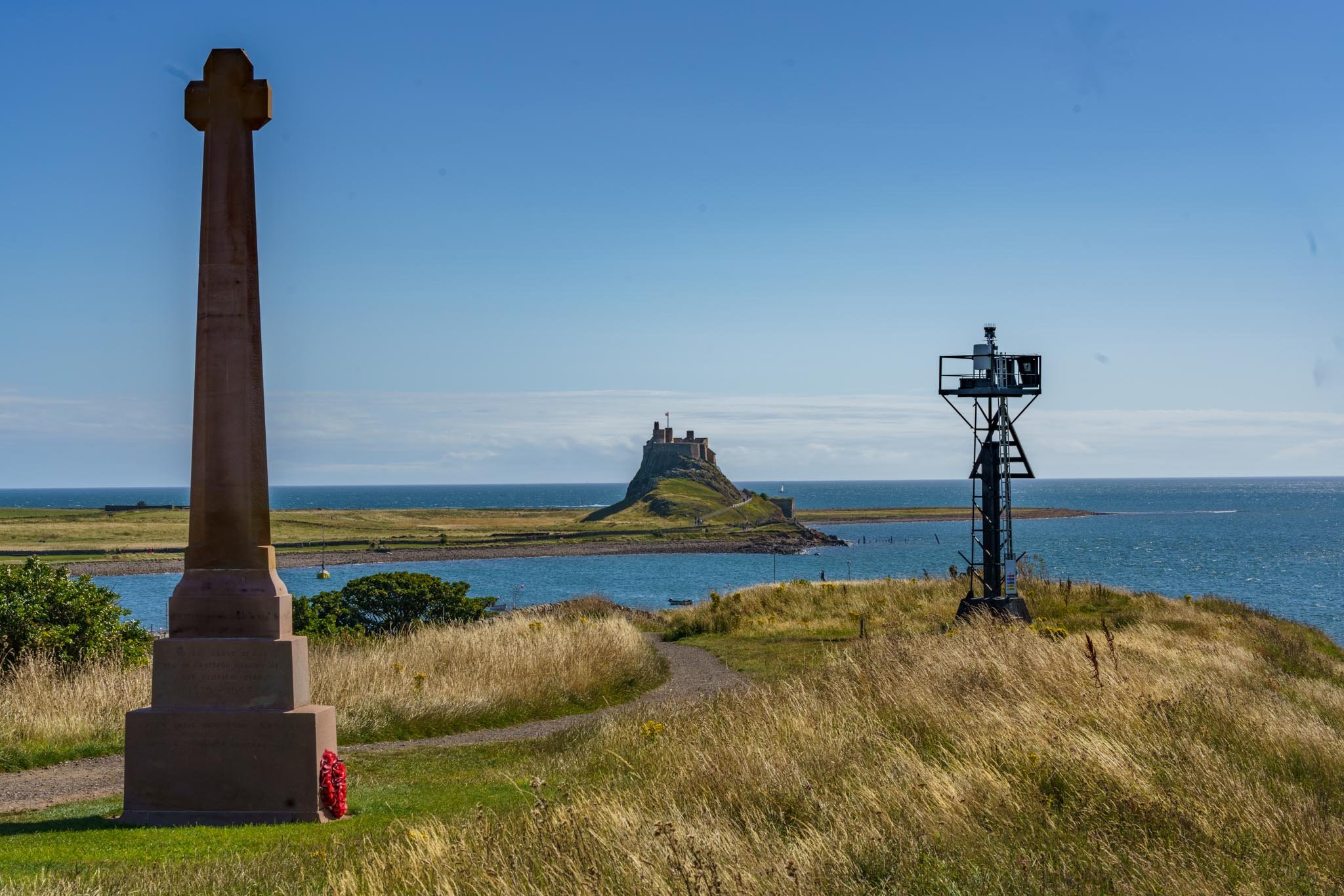
Just near the lookout tower and the path leading to “the hole”
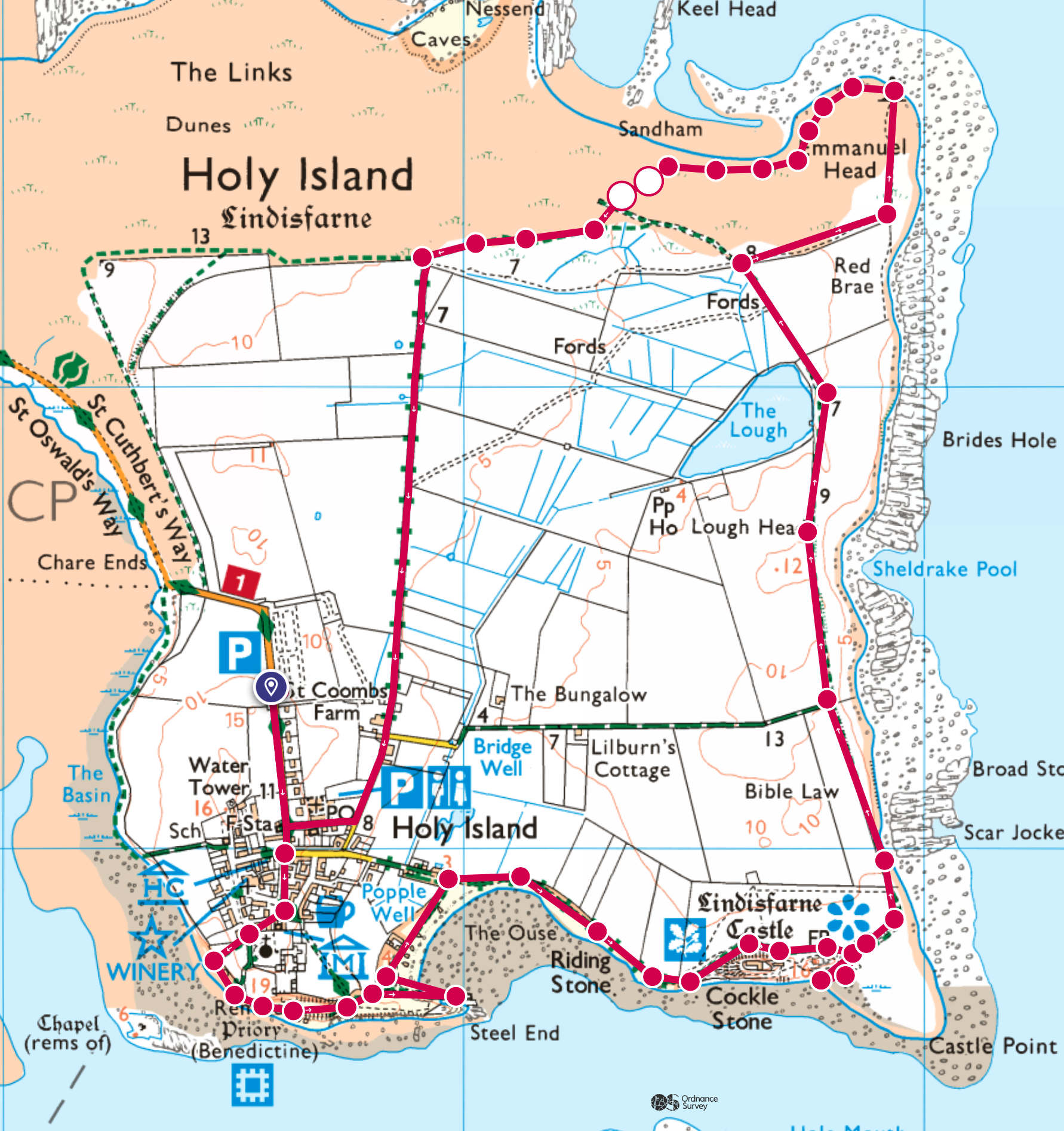
Once over the causeway, we drove for a few more minutes then reached the car park. You do need to pay for parking but it’s not much and worth every penny. Once we parked up, we decided on a rough route we would take. This time round, we planned on doing the outskirts of the island taking in as much as we could.
Our first point to head to was just through the church yard, it took us out onto the beach and we could see and hear hundreds if not thousands of seals on the sand bar across the water. As we had gone when the tide was rising, it wasn’t long before the seals were bobbing up in front of us from the water. I don’t know why but I quite like the look of seals, they just look like water puppies!

My favourite photo taken on Holy Island so far
We moved further on and headed up the hill for a view of the Benedictine Priory which you can visit for a fee. Looking south on a clear day, you can easily make out Bamburgh Castle standing proud on the horizon.
At the top of the hill, there’s a handy lookout tower which I’d recommend exploring for the best views around. After we had spent some time here, we carried on and found the wall with a hole in it. If you’re a photographer, I think this wall is almost like a right of passage. You can’t visit Holy Island without capturing the image of Lindisfarne Castle through the hole in the wall!

Such a clear sunny day, simply beautiful
Our daughter spent a lot of time playing on the rocks here and I have since been back and taken a couple of my favourite photos of Holy Island from this area.
After playing a little and watching the fishing boats come and go, we followed the path further round towards Lindisfarne Castle. The path was very quiet the day we went and I think that is because we had timed it so we stranded ourselves on the island.

The local fishing boats all moored up safely
Reaching the castle, I left the girls to go and explore the path round the castle while I opted for the lower route along the side. It gave me an opportunity to see the castle up close and the scale of it, just seeing sitting on top of the rock formations, perched perfectly is incredible. A few photos grabbed and off I went towards the lime kilns, I met back up with the two troublesome ones and went to investigate the kilns. They are pretty cool to go into! The views out of them are really spectacular, the contrast between the darkness of the kilns and the light of the distant horizon sells itself to me.
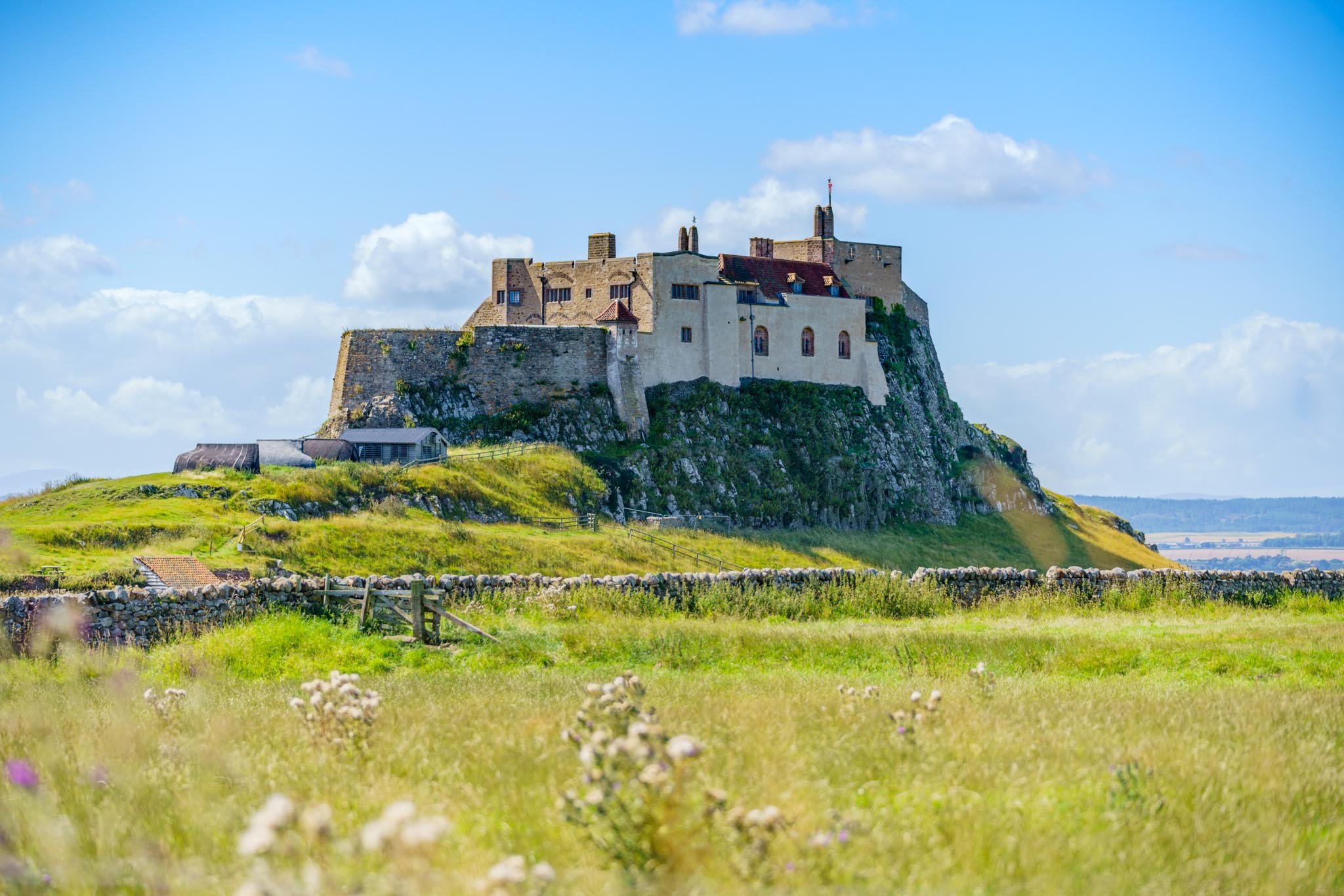
The towering castle in all its glory
Enough climbing done in the kilns so off we went to find our picnic spot on the beach. There was a bit of a breeze that day so we went further round and found a nice spot just below the little ledge to the beach. From here, we could watch the seals swimming around, different shore birds dodging the waves and families making rock sculptures. I’m pretty torn about the rock sculptures, I’m not quite sure what to make of them but the people making them seemed to be having fun.

Lindisfarne Castle
All fed and watered so off we went, heading to Emmanuel head at the north east corner of the island. Along the way there was still plenty for us to see. The views back to castle are worth keeping an eye on and there’s a pretty handy bird hide to go and have a look in too. A few swallows were nesting in the roof boxes so we sat and watched them undertake aerobatics right in front of us.
Emmanuel head wasn’t too far from us now and as we made our way there, you couldn’t miss it. It’s bright glow reflecting the sunlight like a beautiful white pyramid. It’s a 35 foot high navigational daymark and has a few benches perched around it. I sat for a while watching Gannets dash backwards and forwards and diving birds doing a spot of fishing.
From here we followed a path through the dunes and back around to the car. At one point, two deer appeared in front of us and as we watched them, they watched us. When they had seen all they needed to, the bounded off towards the south end of the island, kicking up grass and dust as they leapt.
If you have never been to Holy Island, put it on your next trips agenda. It’s such an amazing place to visit, you could do a short route, enjoy a pub lunch on the island and explore a little. Or do what we did, take a picnic, walk the edge of the island and explore every nook and cranny it has to offer. We have been so many times now and every time we go it’s different. We find something else we hadn’t noticed in previous trips. If you want my advice, don’t spend fortunes going abroad. You don’t need to when we have places like Holy Island on our doorstep ( maybe not the guaranteed sunshine though!)
A nice and easy 5 miles

Harbottle and Drake Stone
My top routes and places to visit in Northumberland…
We first went here kind of by accident as we had gone to do Simonside originally. When we got to Simonside the car park was full, our fault for not setting off early enough!
I knew the Drake Stone wasn’t too far away from Simonside so off we went to investigate. Getting into Harbottle is easy and when we went, it wasn’t too long after Storm Arwen so the main forest car park was closed. We parked nearer to Harbottle in the Castle car park.
I knew we were chancing it after Storm Arwen and the destruction it caused to a huge amount of areas in Northumberland was clear to see on the drive to Harbottle. The road from Harbottle to Alwinton was completely impassable after the storm as a huge section had completely blown across an enormous stretch of the road. It was cleared when we went but you could still the remnants of cut trees lining the side of the road.
The route walks along the border of the live firing ranges but as long as you stick to the marked path, so make sure you stick to the marked paths and not cross where the signs instruct you not to.

Looking up to the Drake Stone
The first section took us up a slog of a hill then it got gradually easier. It’s not a particularly hard slog as it’s quite short. The whole route is only around 4 miles long but you could make it longer if you wished to.
I’ve added a separate map below where we foolishly tried to tick off a trig point while on a family walk with our then 5 year old. We sat at the Drake Stone and saw what looked like a trig in the distance. Off we went in search of it, long story short, it was tough! No clear defined paths and heather as high as your chest made it tough going. A few tumbles along the way and picking tracks through a recently chopped down wood meant we had a lot of ticks to get rid of when we got home! We counted at least 8 on us at one point! Still a very good walk but it’s not one for the faint hearted. This one I write about here however is a much easier and nicer walk all round.

Little cairn half way up to the Drake Stone
So when we got to the Drake Stone, we couldn’t get over just how big it is! It’s a stunning place to stop and take a rest in the shadow of the rock or have a snack. Either way, it’s worth spending a bit of time exploring, climbing and having a fun time.
Once you’ve had enough of the rock, it’s a fairly easy route back to the car park. As I mentioned before, it wasn’t long after Storm Arwen when we went so I kind of expected it to be trickier than it would normally be.

The Drake Stone
As we approached the wooded section of the route, there were a lot of walkers coming the opposite way to us. Each one of them advising us to turn back as there was no way through the woods due to fallen trees. Little did they know just how determined our daughter is, even at the age of 5, she is always up for a challenge and so were we!

View back to Harbottle
We got to the forest section and as expected and advised by other walkers, the path was no where to be seen. I got the map out and we started picking our way through. We obviously made sure it was safe and if at any point we thought it wasn’t, we would have turned back. It was so much fun! We climbed, crawled, posted the little one through gaps, ducked, climbed and crawled some more and had an absolute blast making our way through the forest section! We loved it but can see why it might not be for everyone.
The vicarage of Alwinton in the distance
When we got out of the woods, we dropped down towards Alwinton and made our way over the River Coquet. Reaching the vicarage was where we turned right and followed up past the Lime Kilns. Not long after that we climbed slightly and got a wonderful view across to where we had just been up. The path took us up and round Harbottle village and back in at the far Easterly end. Since it was such a hot day, an ice cream was very much needed and it just so happened the local pub sold them!
A few Belties relaxing in the field on the way down
A lovely cold drink and an ice cream really topped the walk off. I must say The Star Inn looks a great place for food so we will be back again to try some one day. All refreshed and cooled down we headed back to the car park along the road, finally reaching the campervan.

The other side looking back towards the Drake Stone
Such a beautiful place to visit with many different options for routes. The one we chose this day was around 4 miles and the second map below taking in the trig and ticks was around 5 miles. If you are looking for somewhere that has a steady climb but not too difficult, the easier one could be for you. Just don’t forget the ice cream at the end though whichever route you choose!

A nice and easy 4 miles

A not so easy 5 miles!

Hethpool
My top routes and places to visit in Northumberland…
Nestled away in the College Valley is the charming little place of Hethpool. I stumbled across a post on social media where someone recommended the Hillfort Trail and thought I’d give the place a go.
There’s a fairly substantial car park at the start of the route. It’s worth pointing out that if you want to drive beyond this point, you’ll need to obtain a permit at the cost of £10. I’ll pop the link below should you need to get one.

White Hill
Even just driving here I was filled with excitement. The weather looked amazing, some large dark ominous clouds dotted around in the vivid blue skies. The lush green of the countryside and big shadows casting down the valley. I knew I was in for a treat!
So I found my way there no problem, got parked up, checked the map then off I went. The first very short section is along the road until I came to a small post pointing the way for the Hillfort Trail. I knew the route I had planned wasn’t the official hillfort trail but I’ll save that one for another day.

Rocks where “homestead” is marked on the OS map
Climbing up the side of White HIll, I could already get a sense of the views I would encounter and I was excited. I knew the best bit would be towards the end of the walk but I was already enjoying the initial glimpses of the landscape around me. Carrying on, I reached the top of a ridge and spent a couple of minutes taking a few photographs then on my way I went.

The permit road toward Trowupburn
The next section of the route took me around a wooded area and a group of deer were grazing right before me. I didn’t have my camera out and I didn’t want to scare them away so I just watched them for a while. They didn’t seem to notice I was there at all! Eventually they moved on and so did I, round the trees and back up another small hill, Ring Chesters, to get a different perspective of the area.

View towards The Curr from Ring Chesters
I spent quite a bit of time at Ring Chesters, mainly to eat some food and rehydrate, but also because the views were incredible. A few sheep curiously watched me as I wandered round the top looking out in the distance. Sandwiches eaten, water drank I set off down to Elsdonburn. Such a beautiful place to live, so remote with the most amazing countryside on the doorstep. I’m pretty sure the winters would be harsh but I seriously envy anyone who lives in places like these.
Eldsonburn
When I reached Elsdonburn, I picked up the St Cuthberts Way for a short while before turning right up to Great Hetha. Great Hetha is the highest point on this route and I was looking forward to getting up there to see what it could offer. I was not disappointed, the views were stunning. The clouds offered a beautiful contrast and the lush greens appeared more luminous when the sun beamed onto them.

My favourite photo from the walk. Looking back to Elsdonburn
Over the top and back down Great Hetha took me onto the final stretch or truly gorgeous walk. I followed the valley back to the car and knew the photos would be incredible when I got home. I couldn’t wait to have a look at them properly.

View from half way down Great Hetha down College Burn
Hethpool is a wonderful little place to use as a central starting point. Just looking at the OS maps, there are so many different routes and distances you could choose from. All of them with incredibly beautiful scenery across the valleys and beyond. Add this one to your must do list if you haven’t already, you won’t regret it!

Just under 6 miles

Blawearie and Cateran Hole
My top routes and places to visit in Northumberland…
The word Blawearie roughly translates to ‘tired of the wind’. When you get to it, you’ll certainly understand why. It’s a derelict farm house set in remote Northumberland and is very open to the elements. Cateran Hole is another feature that is found along this route. It’s history is much argued over but most suggest it’s an old smugglers hiding place. The tunnel is said to be around 35 metres in length. There are also various second World War artifacts dotted around the area. The moorland was used for military training back in the day and some of the pill boxes are in great condition to get into and relive the history.
I’ve done Blawearie and Old Bewick a number of times but this particular route is the favourite way to do it for me. It was a week before my second Might Hike and we had originally planned a much bigger walk in the Cheviots. I didn’t fancy the risk of getting any blisters or having an accident as the Mighty Hike was so close, so we picked this route instead.

Hedgehope in the distance
We set off in the car towards Eglingham and parked up by the side of the road. The first section took us past an old pill box and we made our way up the bank towards the top of the first hill. At the top of the hill is a nice trig point to tick off the list. The path levelled out and we made our way across the heather covered moors. I jumped a mile when two Short Eared Owls took off from the heather in front of us! Typically I hadn’t brought my camera this day and getting a photo of an owl is on my list to do. I may come back at some point and have another look.
We eventually got near to where we thought Cateran Hole should be and I imagined it would be easy to spot. I was so wrong! It took a few minutes of scrambling about to find the hidden entrance. You can see why it might have been a good spot for smugglers!
Going into the cave is a must. You’ll spot carvings on the rocks dating back hundreds of years. There’s lots of history in this place and as you travel into the cave further, the light almost disappears. I’d recommend a head torch or your phone’s torch so you can investigate the cave further. Fool’s Gold lined the roof of the cave and shimmered when the light hit it too.
We came back out and sat to scoff some grub, no noodles this time round! A full belly and we carried on towards Blawearie. The track is easy to follow and this day it was dry but be aware if it’s been quite wet, there are sections that are pretty boggy.

Snow and cloud covered Hedgehope in the distance
Coming from the direction we did, Blawearie just appeared. We went over a ridge, through some crags and there it was! The abandoned Shepherds Hut with a couple of trees and big boulders and crags surrounding it. When we went, there was a lean to shelter put up, presumably for the shooting groups to shelter and have bite to eat and some drinks? This is an amazing place to stop and spend some time exploring so allow yourself a bit of extra time here.

Cup and ring marked stones can be found around Old Bewick and near to Blawearie
There are several cup and ring markings on the surrounding stones. A couple of tree swings that someone had kindly put up are there too. There are also a few Bronze Age Cairns dotted around the place which really added to the atmosphere of the place.

Room with a view of the Cheviots
After exploring the building and surrounding area we made our way towards Bewick Hill and kept our eyes open for more cup and ring stone markings. On top of Bewick Hill are two ancient hill forts and a WW2 pill box. This has to be the best pill box to go into, the view out of it is absolutely incredible!

Pill Box with the best view of Northumberland
Making our way towards the end of the walk we followed the footpath through the farm and back down to meet the road. Back at the car, muddy boots off and all safely still one piece, I felt ready for taking on the big Mighty Hike 26 mile walk!

Blawearie
This route has a huge amount to offer and I think it’s one for all the family too. Lots to keep both kids and adults interested all along the route. The stunning scenery, cup and ring rocks, caves, boulders to climb on, swings to play on, old ruins to explore, Bronze Age cairns and a pill box with the best view in Northumberland. What else could you want from a relatively easy walk. If you haven’t explored this area, you simply must put it on your list. It’s a perfect example of the history, geography and landscape of Northumberland.

Just over 8 miles in total
Macmillan Mighty Hike - A Big One!
My top routes and places to visit in Northumberland…
The Northumberland coast offers some of the finest coastal walking in Europe. The Northumberland Coast Path follows this stunningly beautiful coastline for 100 kilometres (62 Miles) from Cresswell in the south to Berwick-upon-Tweed in the north.
I had a bit of a crazy moment egged on by some friends to take part in the Macmillan Mighty Hike along the Northumberland coastline. 26 miles was the distance and to say I wasn’t prepared is an understatement. I think the longest I’d done at the time of signing up was 8 miles max. Training was definately needed for this one! In the months leading up to the big day, we all got together and had training walks in various different places throughout Northumberland. It wasn’t until I went to a family wedding in Devon that I felt prepared. While in Devon, I took on a section of the South Devon coastal path, just over 21 miles. The terrain was tough, much tougher than I imagined but to do over 20 miles set my mind at rest for the Mighty Hike.

Alnwick Castle was the start point for the walk
Around 5 weeks before the big day the unexpected happened. For 10 years or so, I hadn’t played football and one night I got roped into playing to make up the numbers. I wish I hadn’t! While playing football, I managed to slip and fall on my wrist. Seconds later, the wrist was a balloon. Hospital trip needed and they confirmed my wrist was broken. Cast on and pain killers dished out, I headed home. I was gutted, after all the training I had done and being so close to the walk I didn’t know if I should drop out or not.
With my wrist in a cast, I couldn’t drive so in between the odd lift to work, I walked to work and back. Walked to the pharmacy, shops, barbers and found it wasn’t too bad. I felt ok to give the big walk a go. A couple of days before the walk, I was due back at the hospital for a check up. They needed to reset the break as it wasn’t setting correctly, all I can say is wow, the pain was unbearable! It did give me a great opportunity to choose the colour of my next cast though. I opted for a bright green one, it matched the t-shirt Macmillan had issued to us for the walk. So there I was, all kitted out in colour coded cast and t-shirt ready to crack on.
So the big day arrived. Nervously, I got ready and was dropped off in Alnwick to head to the start point. Backpack all ready, full of sweets, snacks, hydration gels, blister packs and pain killers. Here we go!
I found my walking buddies, got my bib number and made for the start. We were off! An early start meant we had the best part of the day to enjoy the route at a leisurely pace. The huge group of people in the first wave made their way out of Alnwick, over the fields, over the A1, through the housing estate then down under the viaduct.
The walk took us round the town of Alnmouth
Carrying on for a few more miles, we reached our first pit stop. So many sweets to choose!!! I grabbed a couple of handfuls, refilled the water bottle and carried on. I must say by this point, around 6 miles in, a lot of people had mentioned they like my green cast. My walking buddy was starting to get a bit tired of the comments already! The next stop was lunch so off we went. Loads of chatting along the way and a lot of support from passers by too which really helped.

The Bathing House with Dunstanburgh in the distance
Carrying along the coastal path led me to one of my favourite spots, Howick and the Bathing House. No time to stop though, our bellies needed filling and bottles filling up! The path came off the coastal route and followed the road up towards Craster Tower. The field was taken over by marquee’s and lunch was fantastic. Sandwiches, pasta, salads, meats, snacks, treats, cakes, you name it, they had it. We spent a good while here to rest our feet, fuel up, tend to blisters and cool down. Once fully rested it was time to start the second half. We were feeling pretty confident at this point and the whole atmosphere helped us along the way. Through Craster the next point was to pass the remains of Dunstanburgh Castle. Such a beautiful view and well worth a trip to on it’s own. Not today for us as we paced past it, walking through the golf course making sure we listened out for the occasional “FORE!”.

Dunstanburgh Castle
Succesfully making our way through the golf course, we followed the path round Beadnell Bay and into Beadnell itself. At this point, I was very low on water so I asked a local how far to the next pit stop. “Only a mile to go” was the response so I downed the rest of my water and ploughed on. After about 4 miles, I realised the local may have been slightly wrong! I was gasping for a drink and also my wrist was starting to give me real issues. I think the heat and the constant swinging had caused it to swell quite badly in the cast to the point my fingers were going purple.

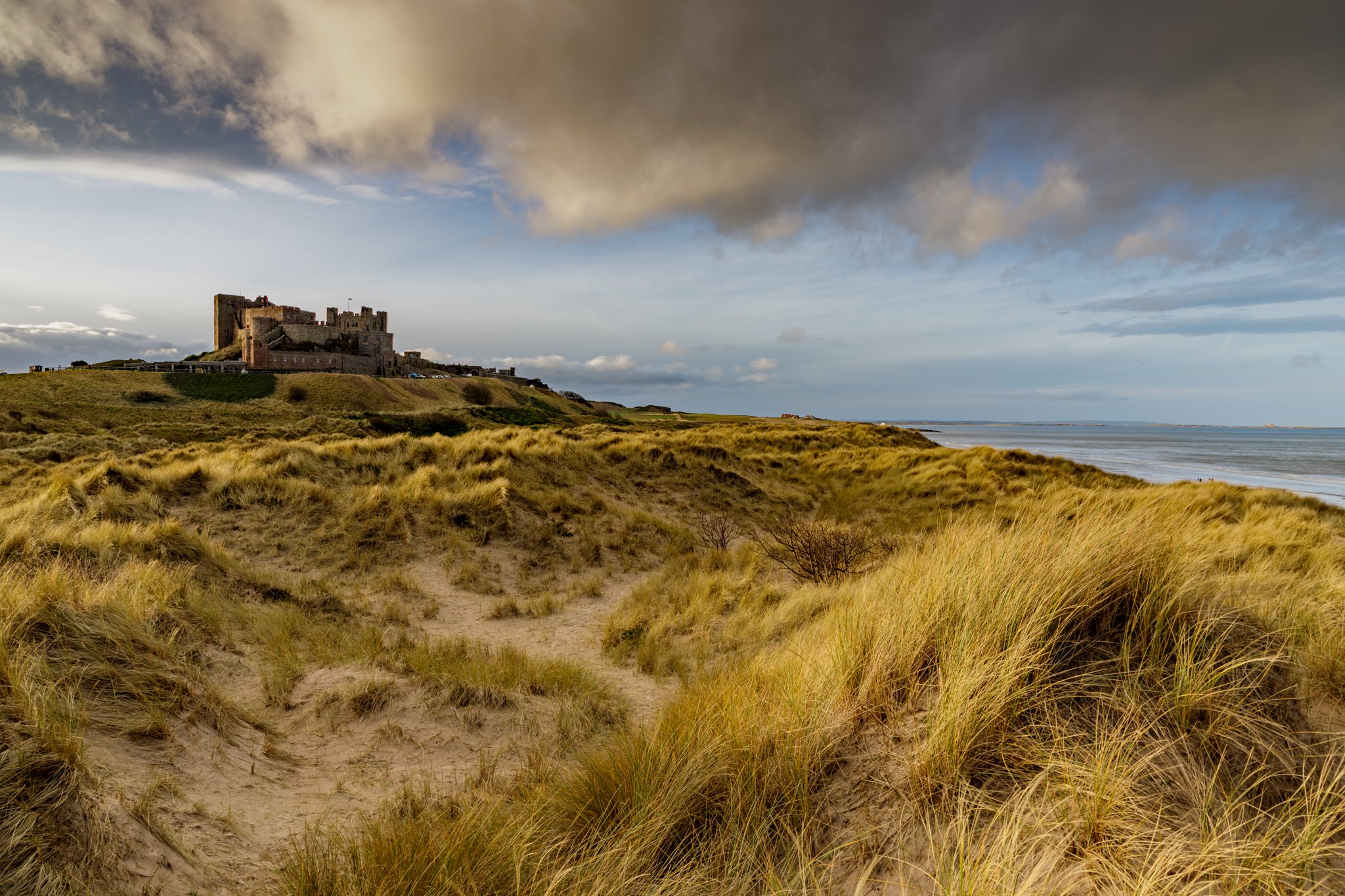
We made it to Seahouses, which was the final chance for a stop before the last leg to Bamburgh Castle. I didn’t want to give in and fortunately I had packed some strong painkillers just for this sort of issue. An ice cream and painkillers did the trick and soon we were back under way. My walking buddy was also struggling by this point with blisters and we all know that blisters are not what you need at this point in the walk. We knew we were almost there and felt so happy about it until about a mile into the last leg. That section from Seahouses to Bamburgh is brutal! I know it’s only about 6 miles but it felt like 26 miles! The road just kept going and going and going. The castle didn’t seem to get any nearer and we knew we were struggling. I guess it was probably at this point when the painkillers kicked in as we found our feet again and picked up the pace. We actually did the last section the quickest of all four sections!
Bamburgh Castle appeared right in front of us, the finish line was right there! The cheers from the crowd spurred us on and the announcer calling out our names was a nice touch too. Over the line we went, glass of bubbly and presented with a nice shiny medal. Obligitory photos taken at the finish and a huge sweaty hug with my partner who met me at the finish line. Before I headed home, I made the most of the food they had put on for us, pizza, two hotdogs and some chips. Then my partner and I drove to Seahouses and had some chippy tea, I couldn’t stop eating!

Bamburgh Castle
The walk was incredible. The atmosphere, the strangers with words of encouragement but most of all, the people I took part with. All of us made it over the finish line and managed to raise a huge amount of money for Macmillan at the same time. After the next few days of hobbling about with sore feet and legs, we all decided to do it all again the following year. It must have been good for us to sign up again!

Just over 26 miles

Sycamore Gap & Hadrian’s Wall
My top routes and places to visit in Northumberland…
Iconic, unmistakable and an incredible place. Unfortunately the place will never be the same now the famous Sycamore tree is no longer there in all its glory.
I had the pleasure of exploring the area several times and always found it a fantastic place. Obviously it was an incredible location for photographers to visit, the symmetry, the colours, the sky as a background with a contrasting subject. This is all true, however Sycamore Gap was more than this, it’s difficult to put into words but it truly was iconic. The tree had a special place in so many peoples hearts for various reasons, proposals, family walks, remembering loved ones who’ve passed, hikers trudging the length of the wall to name but a few reasons.
Although the scene has changed dramatically since the tree was felled in a senseless act, it is still a fantastic area to visit. There are many starting points to routes along the wall, but my go to place always started from either The Sill or Steel Rigg car park. The Sill is a quirky little place with a small cafe, and next door to it is the Twiced Brewed Inn and Dark Skies Observatory. The observatory is well worth a visit and I’d urge you to check out their events. I took my daughter to one in the holidays and we both absolutely loved it, we’ll be back again!

From Steel Rigg the path following the wall
Leaving Steel Rigg takes you down to a lower section of the wall. You pick up the path and climb up some steps carved into the rock until you reach the top. From there you get an amazing view of Northumberland. Walking along the footsteps of hundreds of years of history, it leads you down to a really nice spot, Milecastle 39. When I went the first time, I was amazed at how much of the wall still remained, and it gives you a sense of the scale that the wall used to be. I even sat near to it and cooked up some noodles, soaking in the atmosphere and imagining Romans eating their food in exactly the same spot.

Milecastle 39
All noodled up, I climbed some more steps up to the next mound and carried on. I obviously knew what to expect with Sycamore Gap, the thousands of photos I’d seen other people take gave me what I thought was a good enough expectation. However, when the tree came into view, it honestly exceeded everything I’d imagined. I could see the grand nature of it, perfectly aligned in the little dip that the seed made its home. Walking down to the base of the tree was even better!

Two locals heading home along the wall
I walked further away to get a full view of it in all its glory. I was stunned. It genuinely was such an amazing sight. I’ve taken a few photos from here and they all have their own quirks. Some taken during sunny days, some on misty grey days and some taken at night with the stars moving in the background. Under the tree seemed a popular spot for people to stop and take on drinks or food (much to the annoyance of impatient photographers!).

The iconic Sycamore Gap
I could have turned at this point and headed back to the car park, but I had enough time so carried on. I came across a lough so headed down to take a look. Again, another spot that is worth having a look at. The rocky edge of the wall marries up to the lough just nicely, and it’s a very relaxing place to spend a few minutes.

Crag Lough
After Crag Lough I’d decided to head back to the car. There are two ways you can go, back the way you came or the lower route around the base of the wall and picking the path up at the final section near Steel Rigg car park.

Walking the wall through the mist
Yes, the tree may have gone but the walk is still incredible. Lots of history and views that are stunning too. You can make it as long or as short as you want to. This particular route is only 3 miles or so and has a little bit of height but not much. I’ve had some wonderful times visiting here, meeting new photographers, being out with friends and family to share the experience with and also on my own for a bit of peace.

Around 3 miles
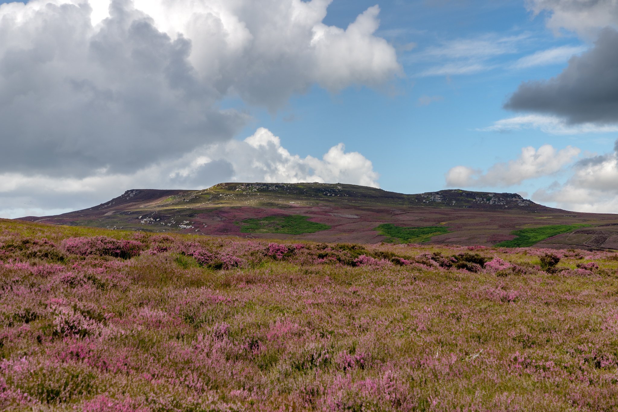
Shaftoe Crags
My top routes and places to visit in Northumberland…
Another favourite is Shaftoe Crags. Located not far from Bolam Lake (another good little walk), it’s easy to find and offers quite a lot for such a short walk.
The walk itself isn’t challenging at around 2.5 miles with little climb in height, but it offers views to the west of Northumberland when you reach the trig point at the top which are incredible.

Look out across the horizon for miles on a clear day
I came across Shaftoe Crags almost by accident one day. I often look at at OS maps and work out new places to visit. One of the things I look for are trigonometrical points, the blue triangles with a dot in the middle on OS maps. The reason for this is that they usually offer great views across the horizon and potentially sunrises or sunsets look great from these points.
Such a beautiful house to live in with these views on your doorstep
So after finding the little blue triangle I drove to where I thought I might get parked according to the google aerial photo maps. You park to the right of the farm track on a grassy field, occasionally stocked with cattle. I got out of the car, checked the map and off I went. I followed the path to the left of the fence, and to the right I could see the distant Northumberland countryside opening up. Once I got to what I thought was the top, I stood and admired the view for a few minutes before heading on further. When you follow the path, it leads you to what is part of an old Roman road nicknamed “Devil’s Causeway”. Looking through the “V” that had been almost cut through created a really good view out into Northumberland.

Wallington Hall is easilly visible from here, seen to the left of this photo
I made my way up to the top of the hill and gave the trig point an obligatory pat. After soaking in the views or snack stop, I headed back down to the path and followed it through a working farm. There are several houses that I absolutely love here, old cottages with fantastic views and almost hidden from the world. Following the path leads you directly back to the parking area and finishes a nice, steady and easy but an incredible walk. You could always extend this walk by parking at Bolam Lake, starting and finishing from there instead, looping the lake walk in too.

Fire in the Sky over Northumberland
This is one of my favourite trig points, not solely because of the incredible views or the ease of the walk but because of the memories it has given me. I have visited Shaftoe Crags several times on my own, with good friends and with my family. I’ve sat on the hill and cooked noodles for my daughter and I, taken shelter from the showers in one of the many caves and watched amazing sunsets turn the sky into fire. It’s just one of those places that I absolutely love. If you’re looking for a shorter walk, this is one I would highly recommend.

Roughly 2.5 miles
Kielder
My top routes and places to visit in Northumberland…
Kielder is one of those magical places that has it all. Forest tracks, waterside meanders and high vantage points. To top it all off, it’s also classed as an Official Dark Skies location so perfect for clear nights observing the stars. Kielder is also home to an array of wildlife and birds, one of which is on my bucket list to go and see, the Osprey. Fingers crossed I’ll see one soon!
The last time I went to Kielder for a walk, I stayed overnight in my campervan at the Pheasant Inn, Stannersburn. Great food, good atmosphere and a nice quiet location to get my head down before the next day’s adventure.

Looking over Kielder Water from the Dam
The next morning, after a bacon butty and big mug of coffee, I set off. I’d never done this walk before so I was looking forward to what I may come across along the way. The first section took me into the little village of Falstone. Quite a small village located on the River Tyne Trail, I happened to be there the same day as their village show, which I had to walk through to carry on with the path I had planned out. Two farmers collared me at the entrance and £5 lighter I was allowed through. I thought “Well if I’ve paid, I might as well have a look around!” Around 4 and half minutes later, I’d looked at everything there was to see so made my way out of the show and up to the Dam. On the plus side they had free WiFi for your fiver!
Looking back to Falstone
Crossing the dam gave me the opportunity to view down the river and across the side the large expanse of water which makes up Kielder. Over the dam I picked up the path that circles the water. Along the route, there are several decent places to stop for lunch, snacks or just to simply take in the view. I stopped off at Tower Knowe visitor centre for a cuppa and a chocolate bar and noticed there was a small hut to the side. It was an information point about the nesting Ospreys that use Kielder as their home for a few months each year. They had cameras set up to view the nests and one came right on cue while I was watching! Although not the same as seeing it live with your own eyes, it was still a pretty cool thing to watch!

Osprey taking in the view
After my brief stop, the next point to make my way to was Elf Kirk viewpoint. This has one of the best views across Kielder Water and it’s well worth the wander to see it. From there the path took me through the forest and that’s where things went wrong. Foolishly, I thought the aftermath of Storm Arwen would have been cleared but in hindsight, Kielder took an absolute battering during that storm so I shouldn’t have been suprised. I should have realised and planned a different route rather than the forest tracks! Anyway, at the point I got to where the track was completely blocked, I had to work out a plan B. The downside to the plan B was that it extended the route by about 4 miles or return the way I came and risk paying another fiver! I know it doesn’t sound much but I had mentally prepared myself for a much shorter walk and this was almost double the original planned route.

Kielder Water in Purple Heather
So carrying on with plan B, I followed a new route I worked out from my OS maps (always have a map, you never know when you might need it!). A couple of miles further along, I had a new problem. Although I had the map and had stuck to the designated paths and rights of way, I had somehow found myself on the wrong side of where I needed to be. I wasn’t too far from the van so I ploughed on, waist height nettles, tall grass, hidden ravines and bogs all made it a slow and difficult climb back up to where I needed to be. Looking back at the map, I can now recommend a different route (as per the map below), stick to the forest track that leads you directly back to Stannersburn, don’t try and follow the footpath, it doesn’t exist. I don’t think the path has been used by anyone or anything other than maybe deer in the last few years.

Kielder Water
I finally got back on track and made my way down the hill back to the van. To say I was relieved was an understatement, change of boots, another coffee and a breather then I packed up and set off for home and a nice warm, well earned bath.
Last leg back down to Stannersburn
Even though my experience doesn’t sound the best or thrilling, I’d go back in a heartbeat and do it all again. Only this time, I’d know the distance and also to stick to the track from Bluesteel Rigg to Stannersburn for the final part.

Roughly 11 miles (should have been a lot less!)

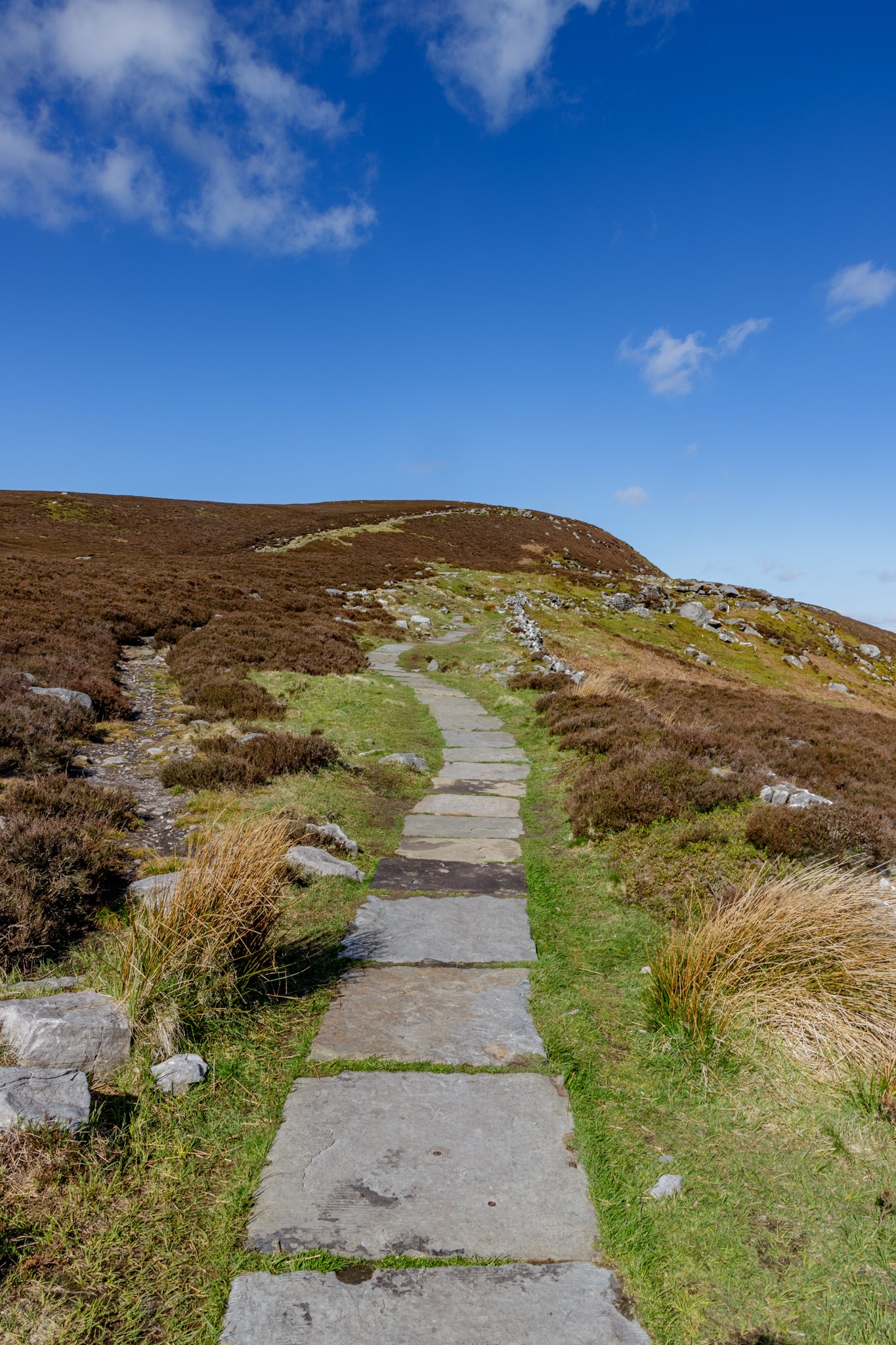
Simonside
My top routes and places to visit in Northumberland…
Simonside is perfect for a wide range of abilities. It’s our go to walk as a family and we also do a yearly challenge to beat our previous times (although we’re not quite at fell running status just yet!).
Located just outside Rothbury, it’s a great location with panoramic views across Northumberland in both directions from the ridge on top of the hills. A large part of Simonside had been closed recently due to the devastating Storm Arwen, which decimated the Northumberland countryside in many places. Now reopened, it’s a brilliant place to stretch your legs and enjoy the views of Northumberland.
Simonside is a recognisable feature for miles around Northumberland
Parking at the Lordenshaw car park starts us off on our route. You can see the steady climb ahead of you as you leave the car park. The route is around 4.5 miles and is a very rewarding hike. The path is decent and there are several places that have huge flagstones laid out to walk along. As you climb the initial part, the view to your right opens up and Rothbury becomes visible.
The path leading up to the Beacon
Once at the Beacon, the path flattens out considerably and you can start to breathe again! Looking to the north gives you a great panoramic view towards the Cheviot and Hedgehope. Making your way across the ridge of Simonside it’s a great opportunity to view north and south and the different landscapes across the horizon.
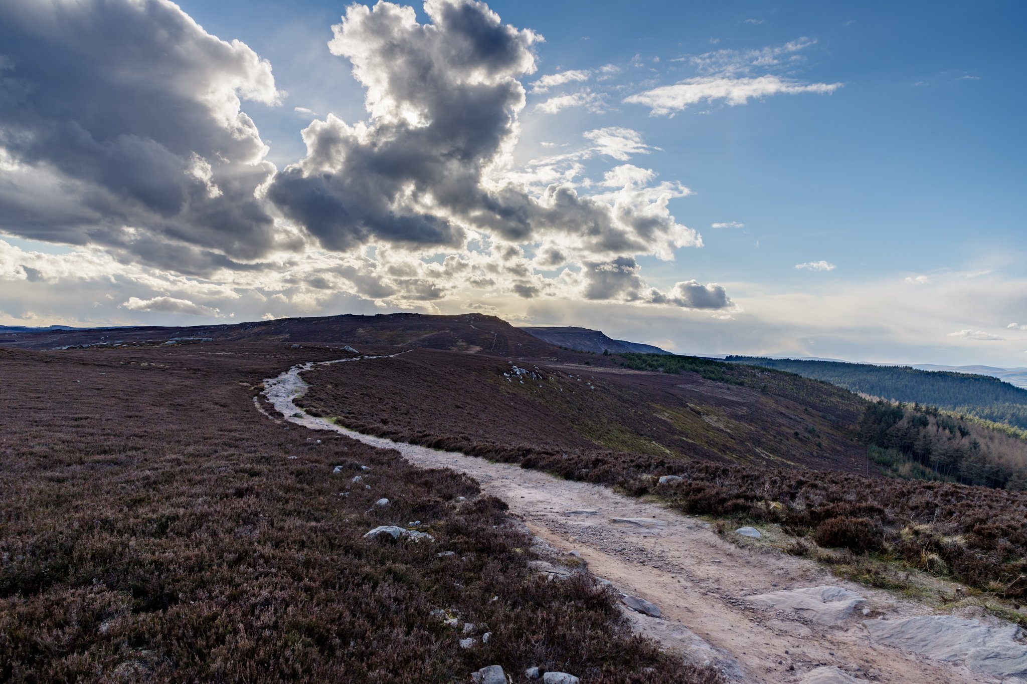
The track walking the ridge to the point at Simonside
Leading away from the Beacon, the next point you reach is Dove Crag, another chance to catch your breath should you need it. Be aware that once at the top of the ridge, you are pretty exposed to the elements so on a wet and windy day, there aren’t any places to take shelter!
Moving further on from Dove Crag (393m) you are walking along the same height roughly as the highest point on the ridge Simonside (430m). The path meanders along nicely and only has subtle variations in height from this point to the end of the ridge.

The path leading from the Beacon to Dove Crag
Once you reach the end of the ridge, you are confronted with a steep descent down to the forest tracks. This looks intimidating but there are a series of steps made from rocks and slow and steady down here wins the race (unless you fancy skipping down it like we do!)
When you get to the bottom the path becomes a forestry track. Very well laid out, flat and easy to hike on. It follows the contours of the hill back to the start point. The path has a gradual height loss followed by a gentle slope up before rejoining the original ridge path you started on. You’ll get to a point on the walk back up the path where the path turns right or goes straight on through the trees. The choice is yours which way you decide to go back, but we normally go straight on and rejoin the ridge path further up the track.

The forestry track looking back at the ridge you have just walked along
Follow the path back up to rejoin the loop in between Dove Crag and the Beacon. Once picked back up, you can simply follow all the way back to the car park. Again, it’s your choice how you come down from the hill. but for us a sprint finish is always the best way, just try not to trip yourself up along the way!

Our choice at the fork presents you with this incredible view towards Rothbury
This loop around Simonside is a firm family favourite of ours. My daughter often asks to come here and explore, seeing adders, deer and other various wildlife also adds to the excitement of the walk. It’s one I would highly recommend. For those wanting to go further, I’d suggest carrying on west from the Simonside ridge and head to Tosson Hill. You can create a longer hike (around 12 miles) including Tosson Hill, round past Fallowlees and pick up the St Oswald’s Way back to the Lordenshaw car park.
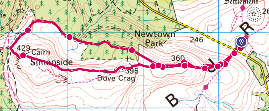
Short route approx 4.5 miles

Longer route taking in Tosson Hill and Fallowlees approx 12 miles

Cheviot and Hedgehope
My top routes and places to visit in Northumberland…
This is by the far the best walk I have taken in Northumberland. At around 10 miles in distance, the height profile of climbing Cheviot then dropping back down and coming back up Hedgehope was a real stamina test for me. The first time I took on the Cheviot was fairly recent, April 2021. The day was beautiful and there was a breeze that blew warm air from the Valley up to the tops of the hills. As you can see from the photos from that day, the views and sky were amazing. You could see for miles!

View from the valley looking at Housey Crags and Hedgehope in the distance right of centre
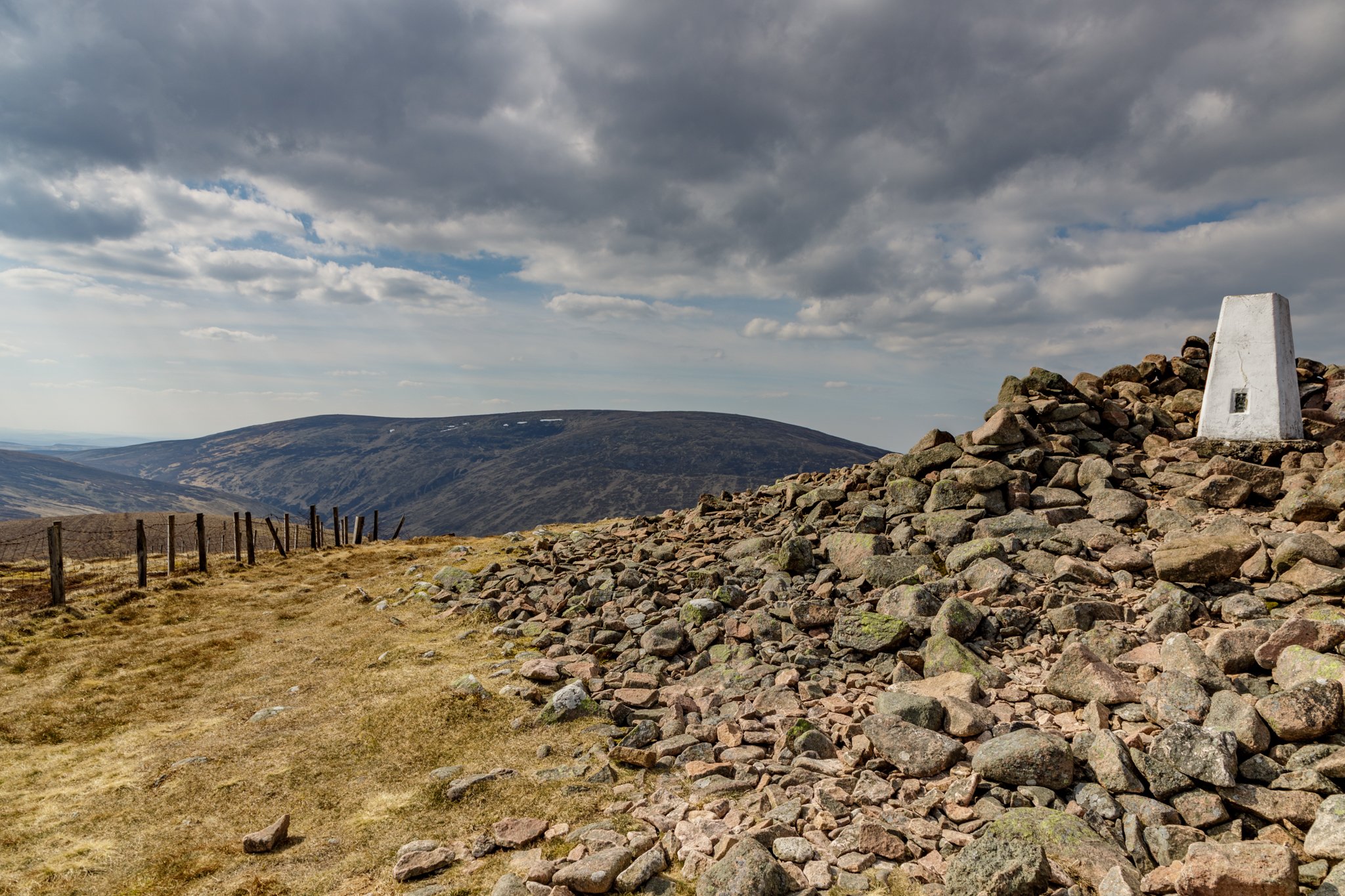
We started off by parking next to Harthope Burn then made our way up to Scald Hill. The view from Scald Hill is great looking down through the valley too! A short breather stop and then we set off again keeping the sight of the Cheviot clearly in our view. I felt it was a long hard slog to what I thought was the top of the Cheviot, but I was mistaken. I soon found out that the Cheviot isn’t a “hill” as such, it’s more of a plateau. Once you get on top of the plateau, the views drop away and you’re left with a big expanse of open untouched landscape. Accidentally stepping into Peat bogs is minimised thanks to the massive slabs that line the Pennine Way, creating a dry safe path to the Trig point of the Cheviot.

Looking back toward Hedgehope
I finally made it to the top and took a well earned rest next to the Trig. The Trig sits on a big lump of concrete which is perfect for sitting on and taking on fluids or fuel before setting back off again. Don’t stay too long as you’ll sharp cool down on a breezy day!

The Cheviot on the horizon
The sense of acheivement overwhlemed me when I sat there. Here I was sitting at the top of Northumberland, someone who up until recently really didn’t like going for walks. It felt amazing until... I realised we had it all to do again!
Off we trudged along the Pennine Way, soon turning left to drop height down towards Harthope Burn. Then it hit us, Comb Fell! Wow, what a place to try and get across! Although it had been fairly dry for a couple of weeks leading up to our walk, the ground had bogs like you couldn’t imagine. We used the fence to climb across ravines, dodged various deep swamp like puddles, balanced over metal girders and occasionally ended up waist deep in the bog. To my partners disgust and my amusement, I managed to capture some photos of the bog swallowing her up!

Some of the bogs along Comb Fell were easier to see than others!
We eventually got through the bog infested Comb Fell and headed up to the top of Hedgehope. This is where the walk took the prize. The view looking towards the Cheviot and down the valley is truly spectacular. I think for me it was more amazing as we could see where we started, the route along the Cheviot and the place we found ourselves at that moment. It really was incredible.
Again, after a quick break, we made the steep descent down Hedgehope towards Long Crags then Housey Crags. Turning left we dropped back into the valley and picked up the road that led us back to the car.
Hedgehope Trig point looking back towards the Cheviot
The Cheviot may not be everyone's ideal destination, but for me, it stands as a symbol of personal triumph and the thrill of pushing boundaries. The memories of this hike, the breathtaking views, the company, and the unexpected encounters with bogs will forever be etched in my mind, and I can’t wait until I can relive the adventure, albeit with a strategic avoidance of the bogs!
